Travel

Planned and Past

In Deadhorse

This post will turn out to be rather long simply because there is so much to say about Deadhorse and Prudhoe Bay

Welcome to Deadhorse

Deadhorse is the name of the town in the Prudhoe Bay area. It was a fascinating place, much different than I expected. It isn’t actually a town, since few people live there continuously. Most come up and work for a few weeks and then return down south for a few weeks off.

Everything here is about producing oil and the facilities for tourists are minimal. Here is our first view after we got off the plane. Deadhorse View
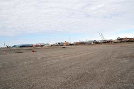
From the picture you can see the terrain is very flat and there are no trees and little other vegetation. Everything is built on gravel pads spread over the permafrost.

Here is a view of our “hotel” the Arctic Caribou InnArctic Caribou Inn
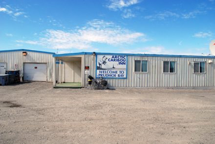
Like nearly every structure here, it is a prefab building that was trucked up the Dalton Highway in pieces.

Continue Reading

When we mentioned we were going to Prudhoe Bay the reaction from some people was “Wow! Cool!” From others it was “Why do you want to go there?” In fact it turned out to be one of the best parts of the whole trip. Here’s a map of the route – the red stars mark places we stayed overnight on the return trip.Prudhoe Map

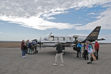
On the northward leg we flew to Prudhoe Bay from Fairbanks. Here’s Jan waiting for the flight to depart.Waiting for a plane

The plane was an AirArctic Piper Navajo. This picture was taken after we landed as my pre-takeoff shots weren’t so good.

Piper Navajo

Continue Reading

June 18

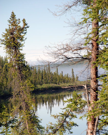
We got up early, grabbed some coffee to go and got on the road. We planned on having breakfast in Glenallan, just a ways up the road. Unfortunately, the place we were considering didn’t look open so we continued on. There was a lot of low lying fog and sometimes the visibility was poor. Eventually things cleared up and we came across two lakes that were gorgeous in the morning sun. Here is a view of Paxson lake reflecting the sky and trees with a fog bank in the background.Paxson Lake

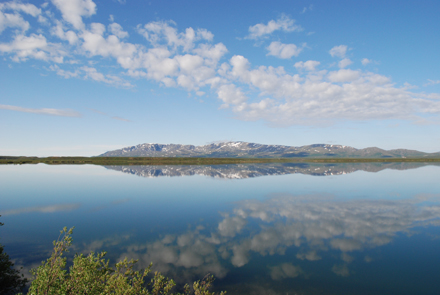
The next lake, Summit Lake was even more beautiful. This may be one of the best pictures of the entire trip. Summit Lake

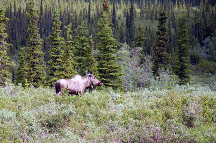
A little later we spotted our first moose. I think this one is a female but I’m not a moose expert. S/he was close to the road when we arrived but quickly moved off when we slowed down.

First Moose

Later on we got some better moose pictures but we were pretty excited about this first chance to see one up close.

Continue Reading

Tok

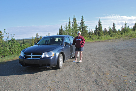
On the morning of June 17 we headed out on our do-it-yourself day tour. We decided to continue up AK hwy #1 to the town of Tok (rhymes with Coke) Here’s a picture of Jan with our rental car at one of the pullouts along the way.Car

The road to Tok goes past the Wrangell St. Elias National Park and Preserve which is a whopping 13.2 million acres total! Because of clouds and haze I couldn’t get the best photos of the Wrangell mountains but here is one shot of 16,327 ft tall Mt. Sanford in the distance

.Mt Sanford

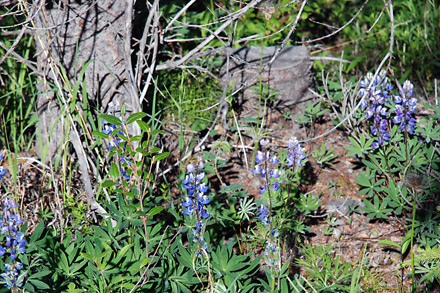
Even with the clouds, the day was beautiful. All along the road were wildflowers of different types. These are Bluebonnets (I think).Blue Bells

When we got to Tok we did typical tourist stuff – went to the visitors center and prowled through some gift shops. Tok is the first town of any size on the Alcan highway past the Canadian border so it was quite busy. Once again, by dumb luck, we found a great place for lunch; Fast Eddie’s . Good food, an huge salad bar and friendly people. Some say it’s the best restaurant on the Alcan highway.

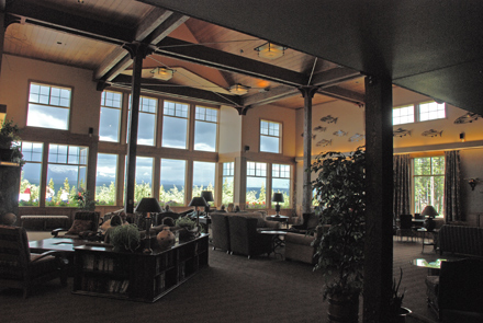
We got back to Copper River Lodge a little early and so I was able to get a photo of the lobby without the mobs of bus passengers. Copper River Lodge lobby

The train arrived in Anchorage fairly late on the 14th of June and we barely got to our hotel in time to have dinner before the dining room shut down. The next morning we picked up our rental car and did a little touring around Anchorage. We had lunch at a cool brew-pub called The Glacier Brewhouse. Their Amber Ale was great! After that we stopped at Resolution Park which is right downtown overlooking the Cook Inlet. They claim you can see Mt. McKinley from there but, in my opinion, it would have to be an awfully clear day.

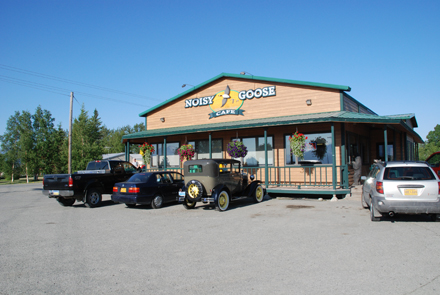
The next morning we encountered one of the few negative things about traveling in Alaska – Tour Buses! When we got up we thought we would have a quick breakfast at the hotel and head out for our next stop. Unfortunately the hotel was jammed to the gills with people on bus tours, all wanting breakfast before the buses left. We decided to postpone eating until we found someplace less over-run. This turned out to be good as we found a neat little place for breakfast down the road called the Noisy Goose Cafe.Noisy Goose

Notice the wonderfully restored old Ford sitting in the parking lot. We noticed many well (and some not so well) preserved vintage cars all over Alaska. Don’t know the reason but they were common.

We continued east on Alaska highway #1 from Palmer. The scenery was fabulous. Almost every direction we looked it was beautiful. Here is a typical scene of the forest and mountains along the highway. I believe these were the Chugach Mountains.Mountains along highway #1

Continue Reading

Almost Home

We are finally staying in a place where I can get on-line and report on our trip. In short, it has been a super vacation. We’ve taken about 17 GB of photos and will be sorting them out once we get home. That may turn into a long job.

Since my last note from Fairbanks we’ve been to Prudhoe Bay, Coldfoot, Fairbanks (again) Denalli, Talkeetna, Seward, Homer and now are back in Anchorage. I can’t begin to describe everything we have seen but I will do day-by-day entries after we get home and back to what passes for normal with us.

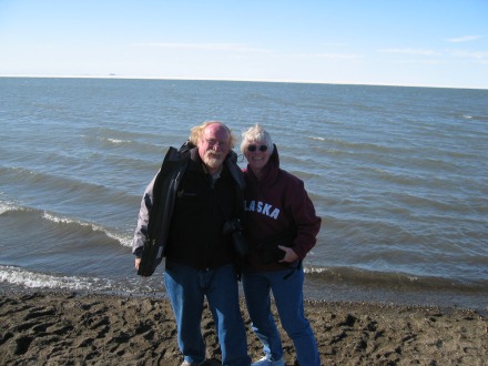
As a little preview, here is a picture of me and Jan, standing on the shore of The Arctic Ocean.Arctic

Fairbanks

We made it to Fairbanks today (from Copper Center).  I am using the hotel computer, as our laptop is still very ill.  We had a great drive up here through some beautiful country.  Saw moose along the way plus some very beautiful lakes and mountains.  I’ll put up pictures when I get home.

 Tomorrow we fly off to Prudhoe Bay.  Takeoff at 8:30am.  I’m pretty sure we won’t have Internet access but we will be back in Fairbanks on Thursday night and I’ll check in again then.

 Besides the computer problems, all is going well.  Wish I could share more with you all.

Computer Woes

Just a quick note to let you all know that I’m having some problems with the laptop and may not be able to post a lot for a while. 

 Otherwise things are fine.

Juneau to Anchorage

Juneau was a bit of a disappointment. Mostly because of the weather and because we were staying near the airport rather than downtown with more to do and see.

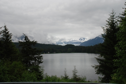
Here is on picture from Juneau that gives an idea of the weather. This is the Mendenhall Glacier and a lake that I didn’t learn the name of.Mendenhall Glacier

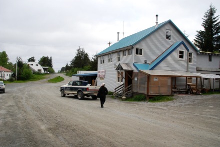
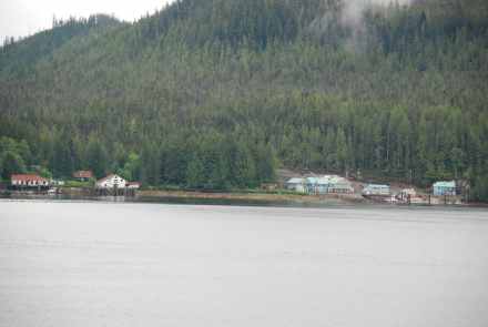
From Juneau we took another ferry, the M/V Kennicott, and headed north again. This ferry was a little smaller and less fancy than the previous one. One of the stops on the way was the fishing village of Yakatak. We got off and wandered around a little. Here is a picture of the general store, which was surprisingly well stocked with anything you might need.Yakatak GS

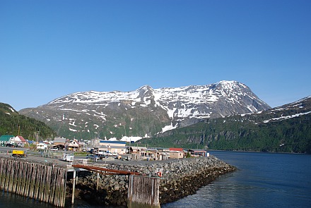
The end of the ferry ride for us was at Whittier. Here’s a picture of the port area with numerous small shops and restaurants.Whittier

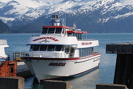
We arrived in Whittier about 7:30am and were scheduled to leave by train that evening at 6:30. In that time we had scheduled a sight-seeing cruise of Prince William Sound. Here’s a shot of that boat, the Nunatak.Nunatak

Continue Reading

Our journey on the M/V Columbia took us from Bellingham, Washington to Juneau, Alaska with stops in Alaska at Ketchikan, Wrangell and Petersburg. Here are some of the many pictures we took along that route.

Note: As I don’t have PhotoShop on this laptop, what you see is not as high in quality as I would like. One of the negatives of near real-time bloging.

The first morning on the ferry turned out rainy, cool and very dark looking. Here is a view of one boat deck that AM

Rain

For the first part of the trip we were in Canadian waters. Here is a picture of part of the village of Bella Bella, BC.Bella Bella

Just north of Bella Bella is the picturesque Dryad Point Lightstation. Dryad Point Lightstation

Continue Reading